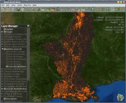
Add-on:USGS NHD Data Demo Add-On
From World Wind Wiki
(Difference between revisions)
Revision as of 17:19, 16 July 2006
| USGS NHD Data Demo | |
|---|---|
| Catchment: all features in the Production Unit.
| |
| Developer | TomServo |
| Latest release | 1.0 / 2006-07-16 |
| License | CC Sharealike license |
| Web site | Add-on website |
[edit] Description
This data is of the new NHDPlus dataset that is being completed. The area covered is Zone 08 which is the lower Mississippi River.
[edit] Notes
The data is in shapefile format and is being served via mapserver. It may be slow if there are a lot of people accessing at once. So it is seems to DL very slowly, wait a bit and try later.
Remember that this is test/demo data and server and subject to later change. This also is not of the whole US but of Zone 08 the lower Mississippi area.
[edit] Links
- Download here: NHD Data Demo Add-on
- Add-on website


