Add-on:US Maritime Limits
From World Wind Wiki
(Difference between revisions)
| Revision as of 20:05, 6 October 2006 (edit) Bull (Talk | contribs) (update forum link) ← Previous diff |
Revision as of 20:07, 6 October 2006 (edit) (undo) Bull (Talk | contribs) (oops) Next diff → |
||
| Line 7: | Line 7: | ||
| latest_release_date = 2006-06-27 | | latest_release_date = 2006-06-27 | | ||
| license = ? | | license = ? | | ||
| - | website = [<adamhil_work> someone make sure to pass this on to tom when he shows up - http://beta.sedac.ciesin.columbia.edu/mapserver/map/GPWv3?version=1.1.1&request=getcapabilities | + | website = http://forum.worldwindcentral.com/showthread.php?t=3237 Forum Thread] | |
| - | [20:41:53] <adamhil_work> you had to hunt for it Forum Thread] | | + | |
| }} | }} | ||
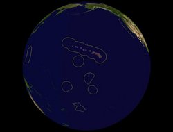
| This World Wind Add-on shows the information for the US Maritime Limits, and was generated from the official ESRI shapefiles. | This World Wind Add-on shows the information for the US Maritime Limits, and was generated from the official ESRI shapefiles. | ||
Revision as of 20:07, 6 October 2006
| US Maritime Limits | |
|---|---|
| US Maritime Limits
| |
| Developer | MangoCrate |
| Latest release | 0.93 / 2006-06-27 |
| License | ? |
| Web site | http://forum.worldwindcentral.com/showthread.php?t=3237 Forum Thread] |
This World Wind Add-on shows the information for the US Maritime Limits, and was generated from the official ESRI shapefiles.


