World Wind Data Sources
From World Wind Wiki
(Difference between revisions)
| Revision as of 13:45, 29 June 2006 (edit) Mkpl (Talk | contribs) m (Reverted edit of 59.162.193.121, changed back to last version by NowakPL) ← Previous diff |
Revision as of 02:58, 15 March 2007 (edit) (undo) 143.232.237.1 (Talk) Next diff → |
||
| Line 1: | Line 1: | ||
| - | * '''Blue Marble''' (1 km/pixel resolution) | + | * '''Blue Marble''' (1-km/pixel resolution) |
| :NASA Goddard Space Flight Center<br> | :NASA Goddard Space Flight Center<br> | ||
| :Earth Observatory | :Earth Observatory | ||
| :http://earthobservatory.nasa.gov/Newsroom/BlueMarble/ | :http://earthobservatory.nasa.gov/Newsroom/BlueMarble/ | ||
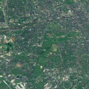
| - | * '''NLT Landsat 7 Global Mosaic''' | + | * '''i-cubed''' (15-meter/pixel resolution) |
| + | [[Image:2022 2858.jpg|thumb|i-cubed highest resolution]] | ||
| + | :Global Land Cover Facility | ||
| + | :University of Maryland, Institute for Advanced Computer Studies | ||
| + | :[http://www.i3.com i-cubed] | ||
| + | |||
| + | * '''NLT Landsat 7 Global Mosaic''' (30-meter/pixel resolution) | ||
| :Global Land Cover Facility | :Global Land Cover Facility | ||
| :University of Maryland, Institute for Advanced Computer Studies | :University of Maryland, Institute for Advanced Computer Studies | ||
| :NASA Learning Technologies | :NASA Learning Technologies | ||
| - | * '''OnEarth Landsat 7 WMS Global Mosaic''' (15 m/pixel resolution) | + | * '''OnEarth Landsat 7 WMS Global Mosaic''' (15-meter/pixel resolution) |
| :NASA Jet Propulsion Laboratory | :NASA Jet Propulsion Laboratory | ||
| :http://onearth.jpl.nasa.gov/ | :http://onearth.jpl.nasa.gov/ | ||
Revision as of 02:58, 15 March 2007
- Blue Marble (1-km/pixel resolution)
- NASA Goddard Space Flight Center
- Earth Observatory
- http://earthobservatory.nasa.gov/Newsroom/BlueMarble/
- i-cubed (15-meter/pixel resolution)
- Global Land Cover Facility
- University of Maryland, Institute for Advanced Computer Studies
- i-cubed
- NLT Landsat 7 Global Mosaic (30-meter/pixel resolution)
- Global Land Cover Facility
- University of Maryland, Institute for Advanced Computer Studies
- NASA Learning Technologies
- OnEarth Landsat 7 WMS Global Mosaic (15-meter/pixel resolution)
- NASA Jet Propulsion Laboratory
- http://onearth.jpl.nasa.gov/
- Shuttle Radar Topography Mission (SRTM)
- NASA Jet Propulsion Laboratory
- http://www2.jpl.nasa.gov/srtm/
- MODIS Rapid Response System (variable 250m/pixel resolution)
- NASA Goddard Space Flight Center
- NASA Science Mission Directorate, Applied Sciences Program
- http://rapidfire.sci.gsfc.nasa.gov/
- USGS Topographic, B&W Ortho, and Color Urban Area
- United States Geological Survey
- Microsoft Research
- TerraServer-USA
- http://www.terraserver-usa.com/
- United States Placenames
- USGS Geographic Names Information System
- U.S. Board on Geographic Names
- http://geonames.usgs.gov/
- World Placenames
- National Geospatial-Intelligence Agency
- GEOnet Names Server
- http://earth-info.nga.mil/gns/html
- United States Borders
- National Atlas of the United States of America
- http://www.nationalatlas.gov/
- Canadian Borders
- GeoGratis service of Natural Resources Canada
- http://geogratis.cgdi.gc.ca/clf/en?action=atlasvectors
- World Borders
- CIA World DataBank II
- Dave Pape
- http://www.evl.uic.edu/pape/data/WDB/ (note: out of date)
- NASA Scientific Visualization Studio Image Server
- NASA Goddard Space Flight Center
- NASA Learning Technologies
- http://aes.gsfc.nasa.gov
- http://learn.arc.nasa.gov/svs/
- GLOBE Program Visualization Server
- University Corporation for Atmospheric Research
- Colorado State University
- NASA
- National Science Foundation
- U.S. Department of State
- http://viz.globe.gov
- Pilbara DEM
- Geological Survey of Western Australia
- Geoscience Australia
- http://www.doir.wa.gov.au/GSWA/
- http://www.ga.gov.au/


